Tourism in Hurghada
:About Hurghada
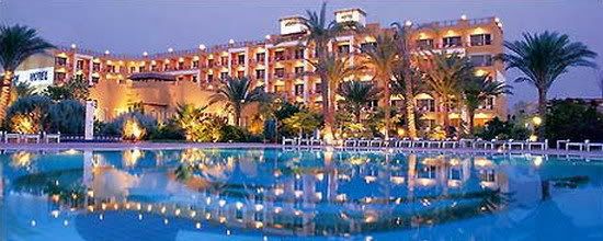
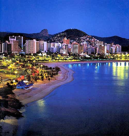
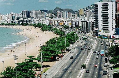
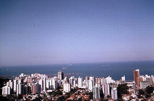
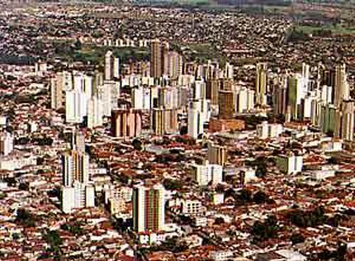
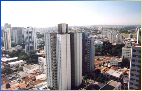
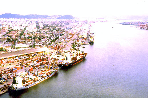
City, "Hurghada" with its unique location on the Red Sea coast are a magnet for the banner for many sectors of tourists due to weather moderate most of the year, and clarity of its beaches vast, and the largest number of villages and tourist hotels in Egypt and a number of natural islands that constitute the environment virgin plant and rare birds, and the practice of some sports recreation such as hunting sea and land.
The city of Hurghada, capital of Red Sea ancient history where it was known as the "Hrgadp" any "desert oasis", divided into two bodies, one on the shore of the Red Sea known as the port and the second home and was known as the "Company" is created by the company to extract oil, the oil of the establishment of workers engaged in extraction of oil oil from the territory of that region.

It derives its unique geographic Hurghada where located on a straight line from the beach of the Red Sea south of Suez
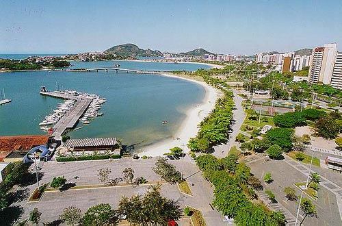
Just as there are big hotels in Hurghada, there are also tourist villages, including all types of tourist services, such as the El Gouna near Hurghada, as well as the Bay of Sumi new project that appears the possibility of various tourism development in Egypt and several kilometers away from Hurghada.
And highlights the attraction as a key feature of this region due to its wealth of fish and coral reefs and natural beauty in the depths of the sea. Keen and concerned institutions in Egypt to ensure the continued attractiveness of this region and its monopoly in the long term. Flock to this region tourists from various ginsengs especially Italians and Germans. And occupies the center of Arab tourists in terms of average time of stay and spending so that the Gulf tourism is greatest in July (July) and August (August).
As for tourism, recreational tourism is confined in a warm, safe beaches to visit during the winter in addition to coral reefs stretching over vast areas and the diversity of the fish, and there are centers of medical tourism on the beach associated with the Institute of Medicine Research Red Sea and the specialty hospital.


There are also many in the Red Sea from the islands of the existing natural Giftun in Hurghada, including large and small, the island of Abu copper moon and Alphenadir WAM and WAM Abu Ramada, Abu Jewish beak and Shedwan.The city of Hurghada, about 385 km south of Suez, was founded the city of Hurghada in the early twentieth century, and is now the most important tourist resort on the Red Sea coast, and a global center for aquatic sports of swimming, fishing and boating, skiing, scuba diving, where the rarest coral reefs, and marine organisms. Giftun Island: a great place to practice diving, and watch the deep sea using a glass bottom boat or submarine. There is also the Museum of aquaculture as well as there are many effects ROMANIAN at Mount smoke near. And there they can exercise safari and exploration of the Red Sea mountainsHurghada Airport
Accommodate Hurghada Airport after developing some 7 million passengers per year instead of 3 million passengers in addition to the galleries arrival and departure of international has been increased space lounge international and domestic travel of 495 m 2 to 1400 m 2 and increase the Contrat service for airlines to 18 Contra instead of 6 Contrat, as well as in lounge access local and international has been to increase the area of 325 m 2 to 1300 m 2 and increased service to 12 Contra instead of 6 Contrat and works with 12 officer passports, was also increased the number of aircraft parking to 38 position was organized parking lot outside the airport and became accommodate 1000 cars and buses instead of only 200, the airport also provided a new navigation kit is able to reduce aircraft landing time of 6 minutes to 3 minutes to allow absorption of more air traffic.
Are found in the Hurghada International Airport facilities, many of the entertainment and services on top cafeterias and restaurants of the highest quality and bazaars, free markets, even chairs that have been developed with the colors and designs where many of the simplicity and beauty and there is also a hall of the Internet can be a visitor or traveler to use at any time, and the corner of the games children who travel with their families and forced to sit or wait in the lounge.
Exercise
Tourists interested in the exercise of forms of sports available to them in Hurghada, which has spread in hotels or on the beach or even over the mountains and the city of Hurghada offer all forms of tourism for the rich or the middle class.
One in charge of sports where diving course costs the equivalent of $ 170 or more in some clubs in Hurghada, there are approximately 150 clubs to teach diving and to teach the sport through the regular price of courses per session up to $ 500 is paid in foreign currency.
The cost per dive start from about $ 30 and will last for an hour and is considered the most expensive areas of Hurghada Diving in Egypt, where the price of a single dive to 46 dollars to 57 dollars in some cases.
The best times of the night diving as diving instructors say there where the fish deposit, calm water.Effects
There are in Hurghada, a number of historical monuments to lovers of history and implications for the tourist can visit the city of Caesar and the ancient citadel dating back to the Middle Ages, and the district or Pharaonic Alfoackher there is the impact of Roman baths is the valley and away from Hurghada about 235 km
El Gouna .. Neighborhoods submerged in greenery
Suburb tourist in Hurghada and away from a distance of 21 kilometers and the El Gouna Hospital built at a cost of 30 million pounds to provide treatment service to the village of El Gouna and the population of the city of Hurghada. And extends El Gouna Bankhvadadtha and islands and channels of water winding along the approximately 10 thousand km, and houses with domes like objects human wearing different colors, designed architecture neighborhoods scattered soaked in green contiguous and overlapping without walls and each district model of the Arab-Muslim, Indian, Mediterranean, African, Latin American and stand out in the biology of the Egyptian spirit touches in addition to El Gouna to receive guests in the seven major hotels spread the place restaurants that specialize in each of which provide most of the world cuisine.
The most beautiful neighborhoods of El Gouna neighborhood known as "Kafr El Gouna" and Bouapute known and popular cafes and hotels and methods of the smell of history.
Tourism Festivals
Host city of Hurghada several festivals, especially with the beginning of the summer festivals such as Hurghada International Squash Championship, organized by the Al Ahram Advertising Agency under the auspices of "Al Ahram" Sport is built in, often in the month of May (May) of each year so as to extend invitations to players squash world of both sexes to play the matches The festival is recognized by the International Federation of squash, which provides for agency-Ahram announced the prizes to the winners at the end of the festival.
This is unlike the Tourism and Shopping Festival, which includes the governorates of Cairo and Alexandria, Ismailia, Hurghada and organized by the Foundation of the Republic every year for the press
She was known for Hurghada Fishing Festival, which involved a number of fishing enthusiasts from young people and public figures.