Tourism in Brazil
:About State


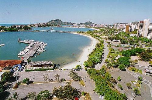
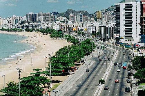
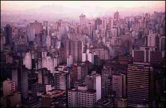
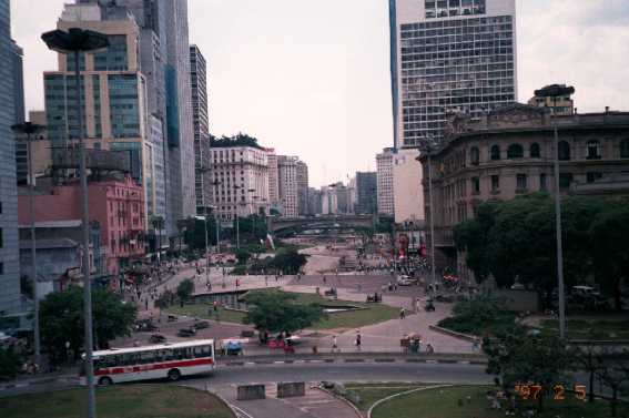
Visited Brazil in 2005 about 5 million tourists and a tourism income of Brazil Milliar equivalent to 4 U.S. dollars, and most States Tourism: Rio de Janeiro 34.7%, Santacatarina 25.1%, 20.3% of Parana, Sao Paulo, Bahia, 16% and 15.5%.
Holidays
: January 1, the beginning of the calendar year: - : April 21: Tiradentes holiday in honor of the Revolution of Minas Gerais in 1789 against Albertgalin : May 1, Holiday workers: to honor workers : 7 September: Holiday Independence the independence of Brazil from the Portuguese : October 12, Patroness of Brazil Holiday (Nossa Senhora Aparecida): to honor the patron saint of Brazil : 2 November Day of the Dead: to visit the graves : November 15: Proclamation of the Republic of Brazil when he turned to the Republic of Ambrootoorip : 25 December: Holiday celebrating the birth of Christ's Birth There are some holidays and non-specific holiday and the Carnival on the death of Christ and the Easter Holiday.
Brazilian states
AcreArabic Acre (Acre), the mandate of the Brazilian and one of the twenty-seven states and the Brazilian is located in the southwest of the northern region of Brazil and limit the jurisdiction of the North Rondonia, Amazon and Bolivia to the east of the south-west of Peru to the south and west of the urban capital of Rio Branco.
The most important cities of the state: Rio Branco, Cruzeiro do Sul, Vyeju, Sina Madojra, Sinador Golmard.
To the nineteenth century was part of the mandate of Acre from Bolivia, since the eighteenth century was the greatest population of explorers and PARA Almottagarin paint the rubber extracted from the trees and naturally set up a separate state in Zllk time. In 1899 Bolivians Haolo Isitro the region, but PARA rebelled and fought against them and the case known as Aalem (Alokri problem).
17 Novimbr 1903 after the official signing of the Tratado Petrwboles Aldaima Brazil came to power in the region, Acre, and became part of Brazil, and Brazil in turn paid $ 2 million pounds Istralini of Bolivia and Brazil set up a railway line Madeira - Mamuri.
Economy depends on agriculture and extraction of rubber and animal husbandry.
AlagoasThe state of Alagoas is one of the States of the twenty-first Brazilian federalism is located on the east coast of north-east, Pernambuco is bordered to the north and north-west of the mandate of the conduct of my pocket from the south, the state of Bahia from the south-west and the Atlantic Ocean from the east. Urban capital Maceió.
Consists of 102 Mhaaftp and maintaining the most important:
Maceió, Rio Largo, Santana de Ibenema, the hired Campo.AmapáBrazilian state of Amapá and of the twenty-seven states and is located in the north of the north-east of Brazil, bordered to the north, French Guiana and the Atlantic Ocean from the south and east to the west and the state of Pará and from the north-west Surenami.
Amapá name came from the language of the native population and the means (the land that expires), the state capital, Mkapa and regarded as the most populous.
State depends on agriculture directly and extract the collection: magnesium, it is the mandate of the consumer depends on the state of Pará to its proximity to the state and less involved in the national productionAmazonAmazon's largest state, Brazil is located in the north and bounded to the north of Venezuela and Roraima and Pará from the east From the south-east Faihdha the state of Mato Grosso and from the west and the state of Rondonia and Acre to the south-west also Peru to the west and Colombia to the north-west with its capital city-Manaus
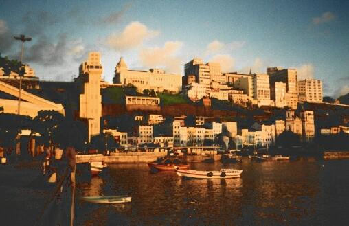
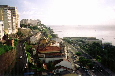
BahiaBahia, one of seven states and twenty-Alfdarlep Brazil located in the north-east and cross the state most closely connected to other states and is bordered to the north (Sergipe, Alagoas, Piaui, Pernambuco) and bordered to the south state of Minas Gerais and Espírito Santo and the Western state Tocantins and Goiás and from the Middle Atlantic and is considered the most important state in the north-east and the most important destination for tourists, its capital city-SALGADO.
The most important cities in the state after SALGADO, Vera da Santana, Vitoria de Kounkuesta, Ilheos, Porto Seguro, Paulo Afonso.
Economy: The state relies on the industry (cars and parts, chemicals, petroleum chemicals), Azzap, animal husbandry and tourism.
CiaraThe state of Ceara is one of seven states and twenty-Brazilian and located in the north-east of Brazil, and limit the jurisdiction the Atlantic Ocean from the north and north-east and the Rio Grande de Norte and Paraiba from the east, the state of Pernambuco from the south and the State of Piauí from the West. Urban capital Fortaleza.
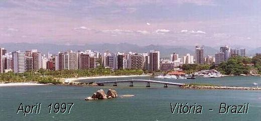
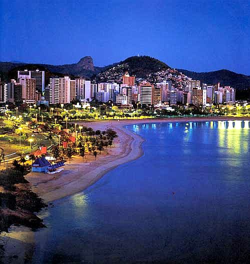
State depends mainly on livestock breeding and tourism.Espírito SantoEspírito Santo (Portuguese: Espírito Santo) is a state located in the south-east Brazil. Called ES for short. Vitoria, capital, and largest city of Vila Velha. Area of 46 184 km 2.
Goiás
The state of Goiás part of the seven and twenty brazilian state located in the east of the western half in Brazil, is bordered by Tocantins from the north, and Mato Grosso to the west and the state of Minas Gerais to the east and south, and the mandate of Brasilia in the Middle Oidhao capital urban Goiânia and is considered the state's most populous the western half, and called on the state the name of the geographical heart of Brazil.
State depends on the industry (iron, food, clothing, medical supplies) and agriculture (rice, soy, sugar cane and cotton) and animal husbandry.MaranhãoMaranhao is one of the twenty-seven states located in the west of the Brazilian north-east, and limits the jurisdiction of the North Atlantic Ocean from the east and Piauí and Tocantins state from the south and south-western state of Pará from the West. Urban capital Sao Luis is one of the largest cities in the state.
Economy depends on manufacturing aluminum, tourism and the extraction of oil from the plant Papaso, agriculture and animal husbandry.Mato GrossoMato Grosso (Portuguese: Mato Grosso) is one of the states of Brazil, located in the west of the country. Neighboring Brazilian states (from west clockwise): Godonya, Amazonas, Para and Tocantins, Goiás, Mato Grosso do Sul. The juxtaposition of Bolivia in a South West.
The name "Mato Grosso" means "dense forest". Of the most famous cities of the capital, Cuiabá, in addition to Alta Florista, and Barra de Garcas, and Caceres, and Rondonoboles, and Sinop, and Varzi Grande. In 1977 the state was divided into two halves, first half is the current mandate, and now constitute the second state of Mato Grosso do Sul.
Mato Grosso do SulMato Grosso do Sul (Portuguese: Mato Grosso do Sul) is one of the states of Brazil. Neighboring states of North, clockwise: Mato Grosso, Goiás, Minas Gerais, Sao Paulo, and Parana. Adjacent to the West in Paraguay and Bolivia as well.
Mato Grosso do Sul, literally means "dense forest south", a name inherited from the neighboring state of Northern Mato Grosso, which was part of it even Anksma in the seventies. Is not strange that refers to a population Pmato Grosso incorrectly, prompting the government to change its name to the "Pantanal", a reference to the months geographical features.
The economy of Mato Grosso do Sul primarily on agriculture products, including livestock, which may be the most important. Include other agricultural products also cane sugar, wheat, and soy beans, rice, and cotton.
In 1977 the state was formed after the split of Mato Grosso, and officially calculated as a state two years later in January 1, 1979. Capital city of Campo Grande is also the largest cities. Called the city Brazilian Portuguese local dialect, "Mato Grosso do Su" (not the word harvest).
Minas GeraisMinas Gerais and one of the states of the 27 federal Brazilian and the size of France located in the north-east Brazil and is the second mandate of the populous, which has a population of 21 million people, the state capital, Belo Horosenti, and played the state a major role during the Portuguese occupation of Brazil Ctwaiha gold yellow, and of the most famous cities Altargep (Villa de Oro) in Arabic and gold district (Ouro Preto) Arabic black gold.
ParraThe state of Pará and the Brazilian states located in the north-central Brazil, and is bounded Surenami and Amapá to the north and the east North Atlantic and the mandate of the Maranha from the Middle and Tocantins in the south-east and Mato Grosso to the south, the mandate of the Amazon to the west and the state of Roraima and Guyana in the north-east and the state capital of Belem urban. It is a hot, wet behind the most important earnings risk: rubber, wood, steel, and Brazil nuts, and medicinal plants.
, The most important cities in the state (Belem, Marrapa, Santarém, and Castaniel Redensaw)
ParaíbaParaíba, one of seven states and twenty-Brazilian and is located in the northeast of Brazil is bordered to the north and the state of Rio Grande do Norte and the Atlantic Ocean in the east and the state of Pernambuco from the south and the state of Ceara in the west, its capital, João Pessoa, and the most important cities in the state: Campina Grande, Santa Rita, Patos, Swoza, Guarabira.ParanaUnit of the 27 federal states of Brazil located in the south of Brazil, its capital, Curitiba, and has an area of 199.907 km and a population in 2005 was 10,261,856 million people, the most important cities in the state of Paraná: Londrina, Marenga, Baranjuoa and Punta Grusa.
PernambucoThe state of Pernambuco and one of seven states and twenty-Brazilian is located in the eastern half of the north-east Brazil and is bordered Paraiba and Ceara from the north-west and the Atlantic Ocean from the east Alagoas and Bahia from the south and Piauí from the west and is located in the island of Fernando de Noronha as its capital city-RecifePiauíThe mandate of Piauí, one of seven states and twenty-Federal of Brazil, located in north-west north-eastern region of Brazil and limit the jurisdiction of the North Atlantic Ocean and from the state of Ceara and Pernambuco from the east state of Bahia from the south and Tocantins from the south-west and the state of Maranhão to the west and from the north-west. Urban capital Teresina, the most important cities of the state: Teresina, Barnaiba, Pecos, Florino, Sao Nicolau.
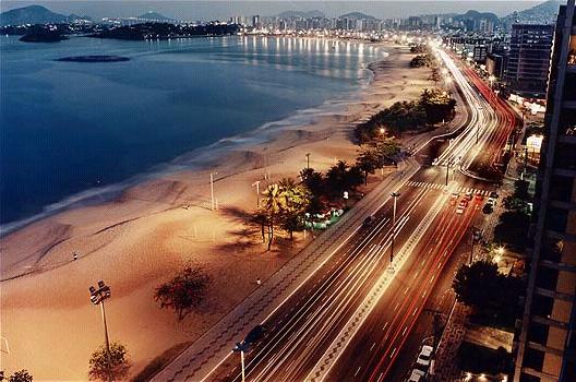
Piaui state of the economy and depend on trade and industry in the line of textile, agriculture and animal husbandry and play an important role in Alaguetsadha also to contain it on the shores of Ultimate in Brazil, and now the state is investing in the cultivation and manufacture of biodiesel.Rio de JaneiroRio de Janeiro of the largest cities Alerasil means River in January in Portuguese. Is one of the most beautiful cities in the world by a lot. State space: 43.653 km and is slightly larger than Denmark and its capital (Rio de Janeiro) and was the capital of Brazil before the construction of Brasilia, the capital of the Brazil current. Have jurisdiction over the most important tourist attractions and most famous beaches in the world, including Obenema and Copacabana.Rio Grande do NorteBrazilian state located in the north-eastern Brazil and the state limits the Atlantic Ocean north and Paraiba and Ceara south west of capital city-Natal, and Rio Grande do Norte in Arabic means great northern river.
The most important cities in the state: Natal, Moussoro, Baranamem, Ceara Mirim.
Is the state most open to the ocean and dubbed (angle Brazil).
State dependent on tourism, agriculture, oil extraction and animal husbandry.
The state of Rio Grande do SulThe state of Rio Grande do Sul and one of seven states and twenty-Brazilian federal located in southern Brazil, an area of statewide 282.062 km and a population of 10.978.587 inhabitants in 2006, the state capital Porto Alegre. Rio Grande do Sul means in Arabic: the great river and the southern Rio Grande is the fourth richest state in Brazil after Sao Paulo, Rio de Janeiro and Minas Gerais. Of the most important cities in the state: Porto Alegre, Pellets, Kayhes do Sul and Novo Homburg
Rondonia
Rondônia (Portuguese Rondônia)
Rondônia - Rondônia
One of the Brazilian Federal States are located in the north of Brazil, bordered to the north and the Amazon state of Mato Grosso and from the east and south of the Republic of Bolivia and Bolivia and the State of Acre to the west.
The most important rivers:GuaporéIqueJi-ParanáMadeiraMamoréParaná-PixunaRoosevelt

:About State
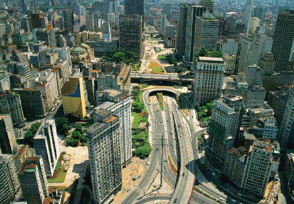
Brazil's largest and most populous area in South America. Is the fifth country in the world in terms of area. Famous for the production of coffee. From the north is bordered by Guyana, Suriname and French Guiana, Venezuela, and West Columbia, Peru and South Bolivia and Paraguay, Argentina and Uruguay on the east by the Atlantic Ocean. Brazil is a country with a strong economy is classified as tenth in the list of countries by annual income. Passes the equator and where large parts of the Amazon River and Their land is so full of tropical forests or areas suitable for cultivation. Capital: Brasilia Population density: 170 million million - Statistics 2002 Area: 8,547,404 million sq. km Currency: Brazilian Real (BRL) International Dialing Code: +55 Time difference from GMT: -3 hour / hours Size of the state than the world: 6.6335% percent of the world Size of the state compared to the continent of South America: 49.5396% percent of the continent Population density than the world: 2.9357% percent of the world's population Population density compared to the continent of South America: 54.2807% percent of the continent's population Largest city: Sao Paulo Official language: Portuguese GNP: $ 1,376,000,000,000 (10) : GNP per capita $ 7.800
Geography:
Heights are Agheiana natural limits of the country with both Venezuela and Guyana. In the north are the plains of the Amazon Basin in the South Pacific or on the one hand there are many mountain ranges may be comparable to low-rise high in some areas 2900 AD. The country's highest peaks are Pico da Nblina near the Brazilian border of Venezuela and above 3014 m above sea level. Amazon's largest river in the world in terms of flow and volume going through its territory. Proof also rivers and Albarrana Alaijuaso and the river Rio Negro, or black and Sao Francisco, Shingo and Madeira.
Brazil followed several islands in the Atlantic Ocean: the island of St. Peter and Paul.Fernando da Noronha
Brazil followed several islands in the Atlantic Ocean: the island of St. Peter and Paul.Fernando da Noronha
Visited Brazil in 2005 about 5 million tourists and a tourism income of Brazil Milliar equivalent to 4 U.S. dollars, and most States Tourism: Rio de Janeiro 34.7%, Santacatarina 25.1%, 20.3% of Parana, Sao Paulo, Bahia, 16% and 15.5%.
Holidays
: January 1, the beginning of the calendar year: - : April 21: Tiradentes holiday in honor of the Revolution of Minas Gerais in 1789 against Albertgalin : May 1, Holiday workers: to honor workers : 7 September: Holiday Independence the independence of Brazil from the Portuguese : October 12, Patroness of Brazil Holiday (Nossa Senhora Aparecida): to honor the patron saint of Brazil : 2 November Day of the Dead: to visit the graves : November 15: Proclamation of the Republic of Brazil when he turned to the Republic of Ambrootoorip : 25 December: Holiday celebrating the birth of Christ's Birth There are some holidays and non-specific holiday and the Carnival on the death of Christ and the Easter Holiday.
Brazilian states
AcreArabic Acre (Acre), the mandate of the Brazilian and one of the twenty-seven states and the Brazilian is located in the southwest of the northern region of Brazil and limit the jurisdiction of the North Rondonia, Amazon and Bolivia to the east of the south-west of Peru to the south and west of the urban capital of Rio Branco.
The most important cities of the state: Rio Branco, Cruzeiro do Sul, Vyeju, Sina Madojra, Sinador Golmard.
To the nineteenth century was part of the mandate of Acre from Bolivia, since the eighteenth century was the greatest population of explorers and PARA Almottagarin paint the rubber extracted from the trees and naturally set up a separate state in Zllk time. In 1899 Bolivians Haolo Isitro the region, but PARA rebelled and fought against them and the case known as Aalem (Alokri problem).
17 Novimbr 1903 after the official signing of the Tratado Petrwboles Aldaima Brazil came to power in the region, Acre, and became part of Brazil, and Brazil in turn paid $ 2 million pounds Istralini of Bolivia and Brazil set up a railway line Madeira - Mamuri.
Economy depends on agriculture and extraction of rubber and animal husbandry.
AlagoasThe state of Alagoas is one of the States of the twenty-first Brazilian federalism is located on the east coast of north-east, Pernambuco is bordered to the north and north-west of the mandate of the conduct of my pocket from the south, the state of Bahia from the south-west and the Atlantic Ocean from the east. Urban capital Maceió.
Consists of 102 Mhaaftp and maintaining the most important:
Maceió, Rio Largo, Santana de Ibenema, the hired Campo.AmapáBrazilian state of Amapá and of the twenty-seven states and is located in the north of the north-east of Brazil, bordered to the north, French Guiana and the Atlantic Ocean from the south and east to the west and the state of Pará and from the north-west Surenami.
Amapá name came from the language of the native population and the means (the land that expires), the state capital, Mkapa and regarded as the most populous.
State depends on agriculture directly and extract the collection: magnesium, it is the mandate of the consumer depends on the state of Pará to its proximity to the state and less involved in the national productionAmazonAmazon's largest state, Brazil is located in the north and bounded to the north of Venezuela and Roraima and Pará from the east From the south-east Faihdha the state of Mato Grosso and from the west and the state of Rondonia and Acre to the south-west also Peru to the west and Colombia to the north-west with its capital city-Manaus
BahiaBahia, one of seven states and twenty-Alfdarlep Brazil located in the north-east and cross the state most closely connected to other states and is bordered to the north (Sergipe, Alagoas, Piaui, Pernambuco) and bordered to the south state of Minas Gerais and Espírito Santo and the Western state Tocantins and Goiás and from the Middle Atlantic and is considered the most important state in the north-east and the most important destination for tourists, its capital city-SALGADO.
The most important cities in the state after SALGADO, Vera da Santana, Vitoria de Kounkuesta, Ilheos, Porto Seguro, Paulo Afonso.
Economy: The state relies on the industry (cars and parts, chemicals, petroleum chemicals), Azzap, animal husbandry and tourism.
CiaraThe state of Ceara is one of seven states and twenty-Brazilian and located in the north-east of Brazil, and limit the jurisdiction the Atlantic Ocean from the north and north-east and the Rio Grande de Norte and Paraiba from the east, the state of Pernambuco from the south and the State of Piauí from the West. Urban capital Fortaleza.
State depends mainly on livestock breeding and tourism.Espírito SantoEspírito Santo (Portuguese: Espírito Santo) is a state located in the south-east Brazil. Called ES for short. Vitoria, capital, and largest city of Vila Velha. Area of 46 184 km 2.
Goiás
The state of Goiás part of the seven and twenty brazilian state located in the east of the western half in Brazil, is bordered by Tocantins from the north, and Mato Grosso to the west and the state of Minas Gerais to the east and south, and the mandate of Brasilia in the Middle Oidhao capital urban Goiânia and is considered the state's most populous the western half, and called on the state the name of the geographical heart of Brazil.
State depends on the industry (iron, food, clothing, medical supplies) and agriculture (rice, soy, sugar cane and cotton) and animal husbandry.MaranhãoMaranhao is one of the twenty-seven states located in the west of the Brazilian north-east, and limits the jurisdiction of the North Atlantic Ocean from the east and Piauí and Tocantins state from the south and south-western state of Pará from the West. Urban capital Sao Luis is one of the largest cities in the state.
Economy depends on manufacturing aluminum, tourism and the extraction of oil from the plant Papaso, agriculture and animal husbandry.Mato GrossoMato Grosso (Portuguese: Mato Grosso) is one of the states of Brazil, located in the west of the country. Neighboring Brazilian states (from west clockwise): Godonya, Amazonas, Para and Tocantins, Goiás, Mato Grosso do Sul. The juxtaposition of Bolivia in a South West.
The name "Mato Grosso" means "dense forest". Of the most famous cities of the capital, Cuiabá, in addition to Alta Florista, and Barra de Garcas, and Caceres, and Rondonoboles, and Sinop, and Varzi Grande. In 1977 the state was divided into two halves, first half is the current mandate, and now constitute the second state of Mato Grosso do Sul.
Mato Grosso do SulMato Grosso do Sul (Portuguese: Mato Grosso do Sul) is one of the states of Brazil. Neighboring states of North, clockwise: Mato Grosso, Goiás, Minas Gerais, Sao Paulo, and Parana. Adjacent to the West in Paraguay and Bolivia as well.
Mato Grosso do Sul, literally means "dense forest south", a name inherited from the neighboring state of Northern Mato Grosso, which was part of it even Anksma in the seventies. Is not strange that refers to a population Pmato Grosso incorrectly, prompting the government to change its name to the "Pantanal", a reference to the months geographical features.
The economy of Mato Grosso do Sul primarily on agriculture products, including livestock, which may be the most important. Include other agricultural products also cane sugar, wheat, and soy beans, rice, and cotton.
In 1977 the state was formed after the split of Mato Grosso, and officially calculated as a state two years later in January 1, 1979. Capital city of Campo Grande is also the largest cities. Called the city Brazilian Portuguese local dialect, "Mato Grosso do Su" (not the word harvest).
Minas GeraisMinas Gerais and one of the states of the 27 federal Brazilian and the size of France located in the north-east Brazil and is the second mandate of the populous, which has a population of 21 million people, the state capital, Belo Horosenti, and played the state a major role during the Portuguese occupation of Brazil Ctwaiha gold yellow, and of the most famous cities Altargep (Villa de Oro) in Arabic and gold district (Ouro Preto) Arabic black gold.
ParraThe state of Pará and the Brazilian states located in the north-central Brazil, and is bounded Surenami and Amapá to the north and the east North Atlantic and the mandate of the Maranha from the Middle and Tocantins in the south-east and Mato Grosso to the south, the mandate of the Amazon to the west and the state of Roraima and Guyana in the north-east and the state capital of Belem urban. It is a hot, wet behind the most important earnings risk: rubber, wood, steel, and Brazil nuts, and medicinal plants.
, The most important cities in the state (Belem, Marrapa, Santarém, and Castaniel Redensaw)
ParaíbaParaíba, one of seven states and twenty-Brazilian and is located in the northeast of Brazil is bordered to the north and the state of Rio Grande do Norte and the Atlantic Ocean in the east and the state of Pernambuco from the south and the state of Ceara in the west, its capital, João Pessoa, and the most important cities in the state: Campina Grande, Santa Rita, Patos, Swoza, Guarabira.ParanaUnit of the 27 federal states of Brazil located in the south of Brazil, its capital, Curitiba, and has an area of 199.907 km and a population in 2005 was 10,261,856 million people, the most important cities in the state of Paraná: Londrina, Marenga, Baranjuoa and Punta Grusa.
PernambucoThe state of Pernambuco and one of seven states and twenty-Brazilian is located in the eastern half of the north-east Brazil and is bordered Paraiba and Ceara from the north-west and the Atlantic Ocean from the east Alagoas and Bahia from the south and Piauí from the west and is located in the island of Fernando de Noronha as its capital city-RecifePiauíThe mandate of Piauí, one of seven states and twenty-Federal of Brazil, located in north-west north-eastern region of Brazil and limit the jurisdiction of the North Atlantic Ocean and from the state of Ceara and Pernambuco from the east state of Bahia from the south and Tocantins from the south-west and the state of Maranhão to the west and from the north-west. Urban capital Teresina, the most important cities of the state: Teresina, Barnaiba, Pecos, Florino, Sao Nicolau.
Piaui state of the economy and depend on trade and industry in the line of textile, agriculture and animal husbandry and play an important role in Alaguetsadha also to contain it on the shores of Ultimate in Brazil, and now the state is investing in the cultivation and manufacture of biodiesel.Rio de JaneiroRio de Janeiro of the largest cities Alerasil means River in January in Portuguese. Is one of the most beautiful cities in the world by a lot. State space: 43.653 km and is slightly larger than Denmark and its capital (Rio de Janeiro) and was the capital of Brazil before the construction of Brasilia, the capital of the Brazil current. Have jurisdiction over the most important tourist attractions and most famous beaches in the world, including Obenema and Copacabana.Rio Grande do NorteBrazilian state located in the north-eastern Brazil and the state limits the Atlantic Ocean north and Paraiba and Ceara south west of capital city-Natal, and Rio Grande do Norte in Arabic means great northern river.
The most important cities in the state: Natal, Moussoro, Baranamem, Ceara Mirim.
Is the state most open to the ocean and dubbed (angle Brazil).
State dependent on tourism, agriculture, oil extraction and animal husbandry.
The state of Rio Grande do SulThe state of Rio Grande do Sul and one of seven states and twenty-Brazilian federal located in southern Brazil, an area of statewide 282.062 km and a population of 10.978.587 inhabitants in 2006, the state capital Porto Alegre. Rio Grande do Sul means in Arabic: the great river and the southern Rio Grande is the fourth richest state in Brazil after Sao Paulo, Rio de Janeiro and Minas Gerais. Of the most important cities in the state: Porto Alegre, Pellets, Kayhes do Sul and Novo Homburg
Rondonia
Rondônia (Portuguese Rondônia)
Rondônia - Rondônia
One of the Brazilian Federal States are located in the north of Brazil, bordered to the north and the Amazon state of Mato Grosso and from the east and south of the Republic of Bolivia and Bolivia and the State of Acre to the west.
The most important rivers:GuaporéIqueJi-ParanáMadeiraMamoréParaná-PixunaRoosevelt
No comments:
Post a Comment